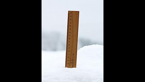
100.9 inches of snowfall... and counting
It’s been a month since Columbus set a record snowfall winter, topping 7.1 feet by the first week in March.
Mother Nature wasn’t done with us yet.
Or rather, isn’t done with us yet.
The first eight days of April have already produced another 19.4 inches of new snowfall in Columbus, according to the National Weather Service (NWS). Add that to the 12.1 inches that fell in March, and this winter’s record shattering snowfall total to date is 109.3 inches, or 9.1 feet.
Columbus has gotten off light compared to Rapelje. With 31.5 inches already this month, Rapelje’s snow total for the season currently sits at 152.5 inches — that’s 12.7 feet.
Mystic Lake’s snowfall so far this year is huge — currently sitting at 293.2 inches, or 24.4 feet, according to the NWS.
Along with the snow came record low temperatures on three days.
•April 3: 2 degrees below zero (previous record low was zero degrees in 1936)
•April 4: 5 degrees below zero (previous record low was 11 degrees in 1982)
•April 7: 2 degrees (previous record low was 14 degrees in 1955). Also on April 7, the high temperature of 19 degrees was the record low high.
“The average temperature for the first seven days of April was 19.6 degrees. This was the second coldest first week of April. The coldest was 19 degrees set in the cold year of 1936,” said NWS Meteorologist Tom Frieders.
MORE ON THE WAY
A Winter Storm Warning was issued by the NWS early Wednesday morning, in effect from Thursday morning, April 12, through Friday afternoon. Heavy, wet snowfall accumulations of six to 10 inches is possible, with wind gusts of 40 to 50 mph.
Although the most severe conditions are expected to occur south and east of Hardin. Approximately 8 inches of new snowfall is possible for the Columbus area, according to the NWS.
There is a 90 percent chance of rain or snow Thursday and Friday, with highs in the low 40s and lows in the 20s. By Saturday, skies should be clear with a high of 51 degrees.
MOUNTAIN SNOWPACK
Mountain snowpack continues to grow. The Upper Yellowstone River Basin is currently at 160 percent of normal, according to the Department of Natural Resources and Conservation (DNRC). Other basins are as follows:
•Missouri Mainstem: 147 percent of normal
•Gallatin: 136 percent of normal
•Madison: 124 percent of normal
•Smith/River/Musselshell: 155 percent of normal
•Jefferson: 135 percent of normal
•Flathead: 142 percent of normal